This is an old revision of the document!
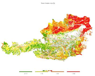
Agricultural land use and environmental indicators at 1x1 km grid resolution- Cropping shares
Main Contributors statistical estimation and concept: Markus Kempen, Thomas Heckelei,Wolfgang Britz, Adrian Leip
Main Contributor GAMS coding: Wolfgang Britz, Markus Kempen
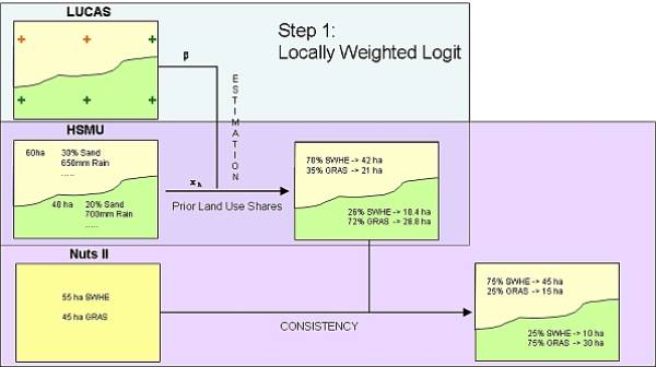
 The crop shares are estimated based on locally weighted bi-nomimal regression models, using the LUCAS sample as observations, and soil and climatic conditions, slope and altitude as explanatory variables. The forecast from the regression model and its error distribution define the a priori distribution for the Highest Posterior Density estimator, which determines the most probable crop shares per HSMU which simulatneously recover the crop areas reported in the Farm Structure Survey, and exhaust the area of the HSMU.

More information
Kempen M., Heckelei T. und Britz W..:
A Statistical Approach for Spatial Disaggregation of Crop Production in the EU
in: Arfini F. (editor): Modelling Agricultural Policies: State of the Art and New Challenges, Proceedings of the 89th European Seminar of the European Association of Agricultural Economists (EAAE), Parma, Italy, Februrary 3-5, 2005 (pages 810-830)
Leip, A., Marchi, G., Koeble, R., Kempen, Britz W. and Li, C.:
Linking an economic model for European agriculture with a mechanistic model to estimate nitrogen losses from cropland soil in Europe
Biogeosciences, 5(1): 73-94


